Running the River Thames
May 19, 2024
|
|
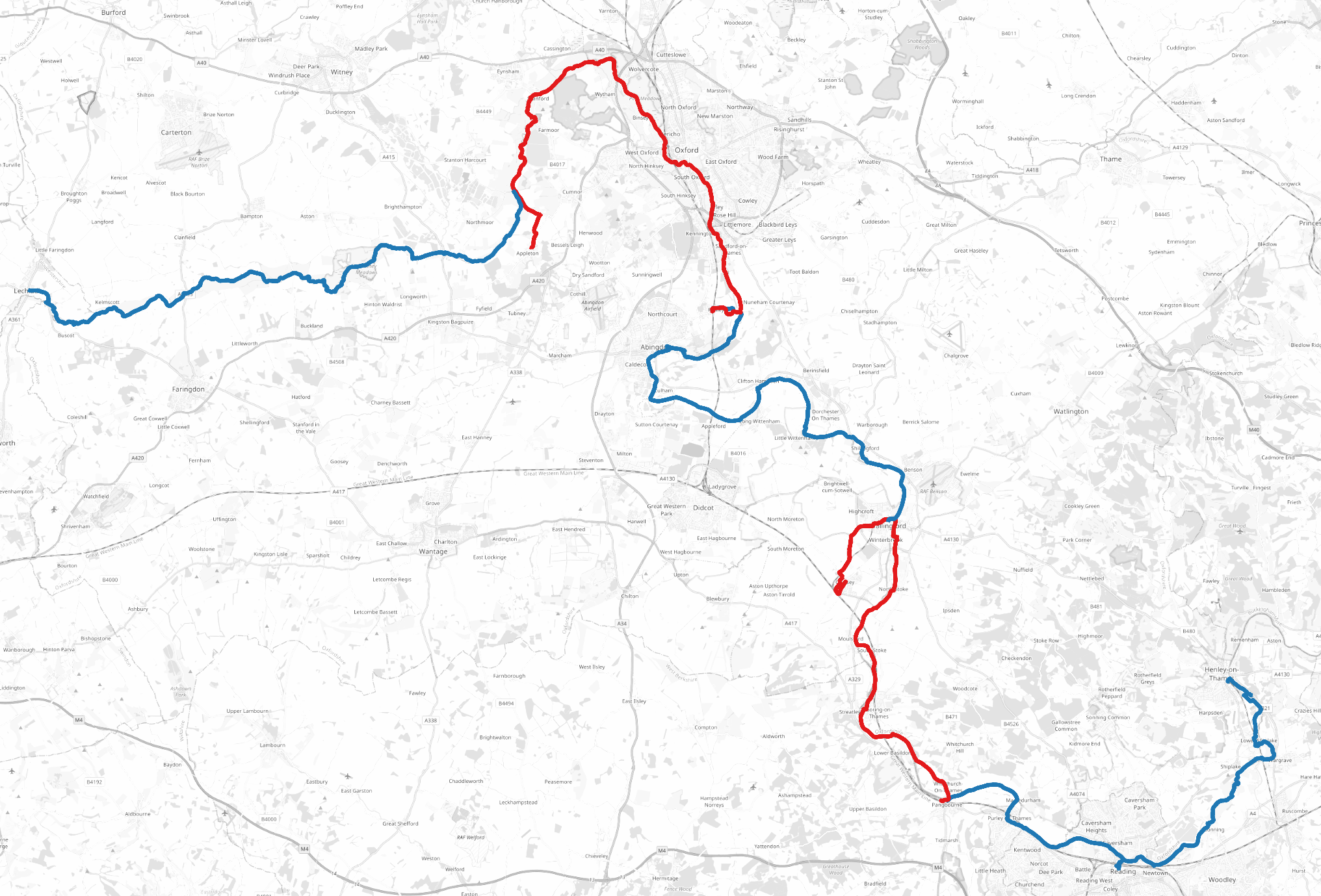
Over the last year and a half I ran the entirety of the River Thames! In total it took 20 runs for a total of over 440km.
Let’s get the obvious question out the way first: “why?” And I, errr, don’t have a good reason. It’s not the first time I’ve done a big themed running project, but it’s by far the biggest I’ve ever done.
Second obvious question: “was it a good idea?” Kinda… I really enjoyed running through a lot of the countryside, and for the most part the Thames Path is very easy to run on. It’s also mostly well connected with public transport, which makes the point-to-point nature of the runs manageable. But on the other hand I often spent far more time travelling than running, which made it a much larger time commitment than “just” 20 weekend half marathons.
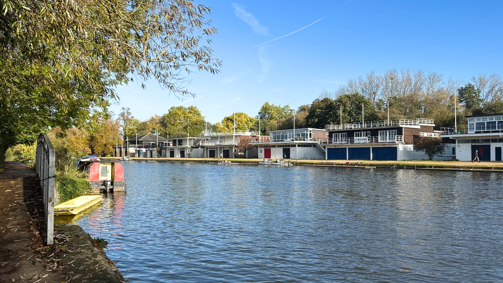
The best part of this project was seeing the contrast in landscapes and communities across the length of the river. Until now my only familiarity with the Thames was with its murky, curvy path through London or the college boathouses in Oxford.
An interesting historical pattern with the Thames — as with many English cities — is that effluence flows downstream and affluence upstream. A lot of this has to do with the Thames’s role in London’s history: for centuries waste water was literally dumped in the river. Land up river became more desirable. It’s no historical accident that the royal court at Hampton Court Palace was far west of the City of London.
Those historical trends are reflected today, even as sewage practices have improved (a little) and London de-industrialised. House prices are twice as high in Richmond-upon-Thames in south-west London than Bexley, in south-east London. Further out of London, on an Essex-bound train I overheard a group of men lamenting the loss of working men’s clubs, an important third place in their communities, whilst in Oxfordshire I sat near a frightfully posh former Home Secretary concluding with a group of friends that taking the train to a party was a “terrifically smart” decision. (Decisions they made in government weren’t quite so clever.)
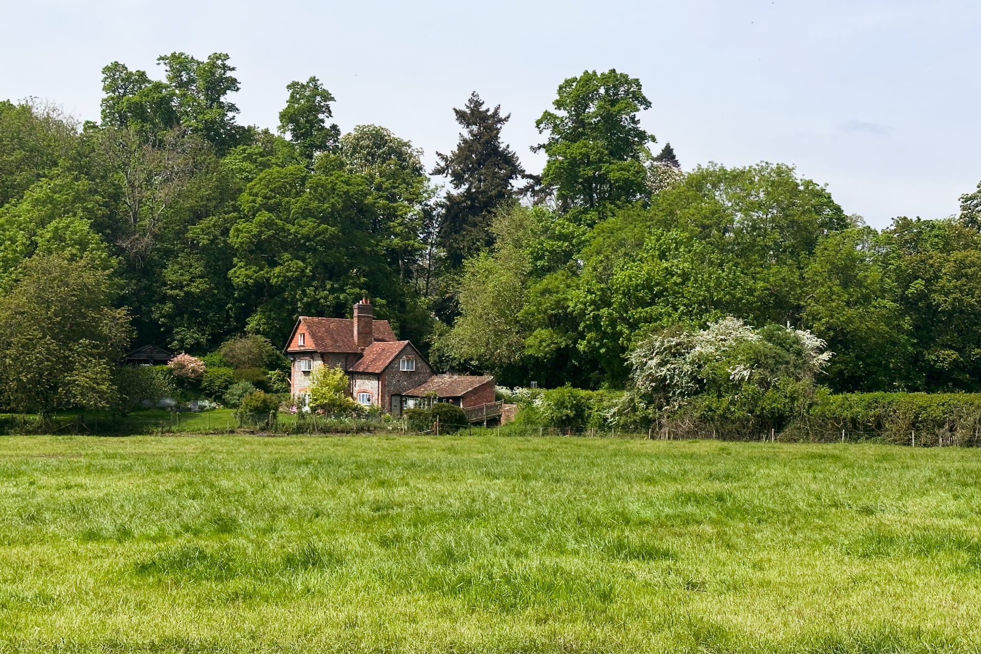
Deeper into the country the Thames cuts a path through “green and pleasant” English countryside. Over the course of my 20 runs I developed a newfound appreciation for it. I’ve genuinely come to believe that we’re incredibly fortunate in the UK to be so well connected to so much accessible, open space.
Gear
I ran with a running vest, a 1.5L Osprey water bladder, a handful of snacks (Clif bars in particular), gels, AirPods, iPhone, and Apple Watch Ultra. I experimented with cheaper water bladders but they’re a false economy: after a few runs they’d start to leak and I’d have to replace them.
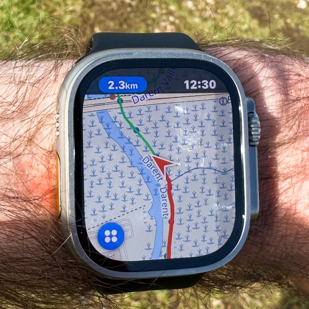
The Watch was the MVP of all these: I used Pedometer++ to display my planned route and route taken throughout each run. The app supports both OpenStreetMap and Ordnance Survey tiles; I generally preferred the former as they were clearer on the small display.
For the most part I was following the Thames Path, but I often deviated around it to either explore other countryside or take shortcuts on routes that would otherwise be too long in one go.
Conditions
I ran mostly in winter and spring 2023 and spring 2024. In the winter months the path was often very muddy, whilst in spring there were sections with very overgrown grass (which was joyless with my hayfever). The Thames burst its banks last year, flooding parts of the path. The Environment Agency has pages monitoring current river conditions.
Towards the source of the river the Thames Path is often just a trodden path along the edge of fields. This makes for a very uneven surface: I had to slow down to avoid turning an ankle.
I only ran in the summer once, but even in spring it was often 20º+ and sunny. Most of the route is very exposed: by the end I regularly ran with a baseball cap.
Logistics
I live in London, which made travel to and from each run easy. (Cities in the UK are well connected by rail to London and far less well to one another.) All in I spent about £400 on train tickets, local buses, and (only twice) taxis. I used a railcard to decrease costs but otherwise I generally optimised for time. I’ve no doubt that booking advance singles, split tickets, or cheaper train lines could reduce the cost by at least £100.
At the end of each run I made a tradition of buying a meal deal (or equivalent) and extra snacks: I spent a further £200 on these.
Between Lechlade, Gloucestershire and Teddington, London the Thames is interrupted by dozens of locks. These locks often have extra facilities for boaters, which the Environment Agency lists here. I learned way, way too late (literally at the last lock I ran past) that this often includes drinking water taps that you can use to refill water bottles. A lock keeper recommended running the tap for 30s before using it.
I’ve posted GPX files for all the routes below.
London and Kent
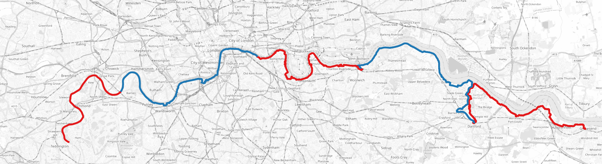
For all the London and Kent routes I took South Western trains, TfL services, or High Speed 1.
The best sections were from Battersea Power Station to Greenwich: you get far more diversity in the built environment on this leg than any other section of the Thames (beyond these points London is mostly just suburbs).
- [1/20] Teddington to Barnes Bridge (12.7km): I started by running west with one of the shortest runs. All of the London sections were very flexible as the Thames path is rarely more than a few hundred meters from a TfL connection. Teddington is the final lock on the River Thames and therefore the start of the “tidal Thames”.
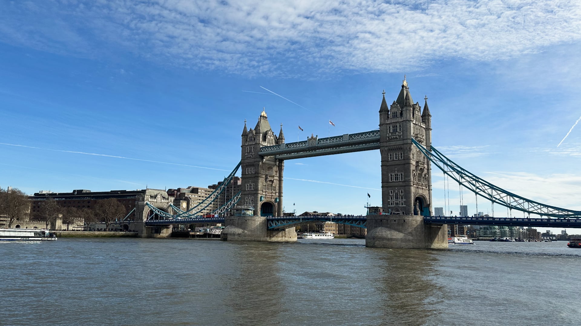
- [2/20] Barnes Bridge to Tower Bridge (21.2km): By far the busiest section as it includes the Southbank. Stopped at Battersea Power Station halfway.
- [3/20] Tower Bridge to Woolwich (19.5km): I had the option to extend this to Abbey Wood (the end of the Elizabeth line) but didn’t have enough energy on the day.
- [4/20] Woolwich to Dartford (21.4km): The Thames Path deviates quite far from the River Thames as it’s interrupted by the Darent from the south.
- [5/20] Dartford to Gravesend (20.3km): This was by far the least pleasant section to run: the sewage treatment plants along the river stink, and the marshes aren’t much better. Gravesend definitely wins “worst place name” of anywhere I went.
Essex
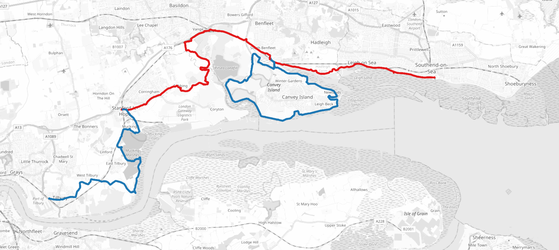
For all the Essex routes I took c2c trains from West Ham and Fenchurch Street. I chose to cross to running on the north side of the river and run the Thames Estuary Path instead of the Thames Path as it was far better connected to London.
- [6/20] Tilbury to Stanford-le-Hope (17km): I ran fairly far inland from the river (the land immediately next to the river was marshy). I wouldn’t recommend this path in winter.
- [7/20] Stanford-le-Hope to Benfleet (19.7km): This section was again quite muddy when I ran it in early spring 2023. Benfleet Station was my starting connection for the next 2 runs.
- [8/20] Canvey Island (23.6km): I ran a lap of Canvey Island because I’m followed by a group of pedants on Strava who would’ve called me out if I skipped it.
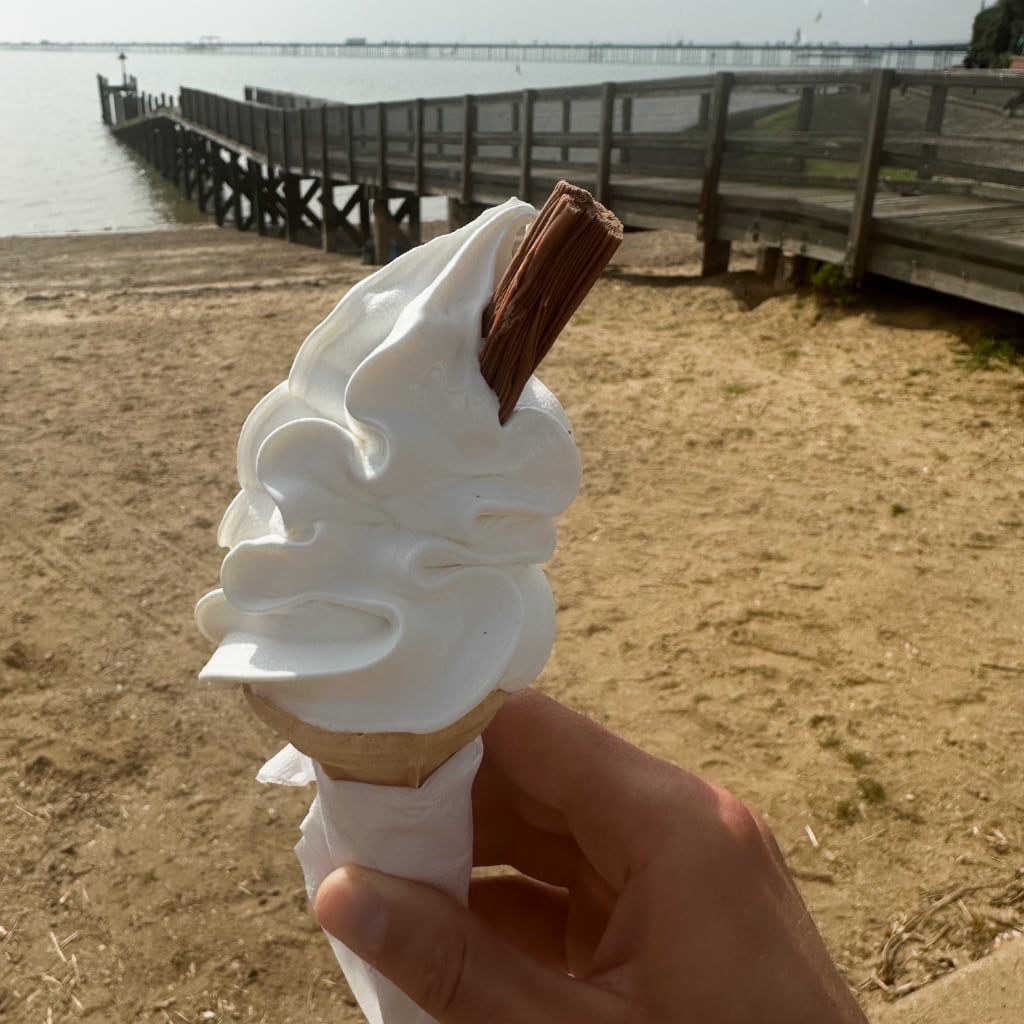
- [9/20] Benfleet to Southend-on-Sea (12km): I concluded I’d reached the end of the Thames when I reached a London Stone at Chalkwell, which marks the end of the Port of London’s Authority. However I continued to Southend-on-Sea because I figured if they’re claiming it’s at the seaside rather than the estuary-side that was good enough for me. Finished with fish and chips and ice cream on the beach.
Surrey, Berkshire, and Buckinghamshire
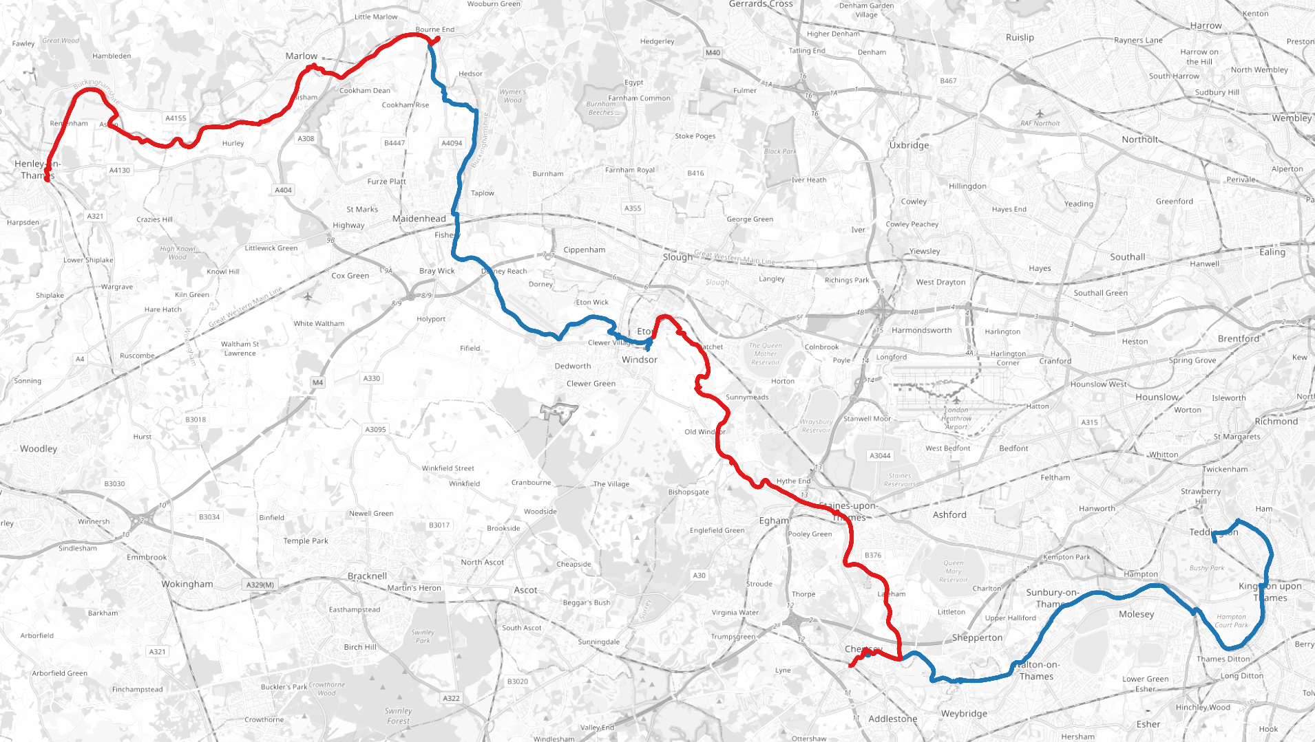
I took a mixture of trains from South Western trains from Waterloo and GWR services from Paddington. As this whole area is still well within the London commuter belt it had by far the easiest train connections, though the trains were often the busiest.
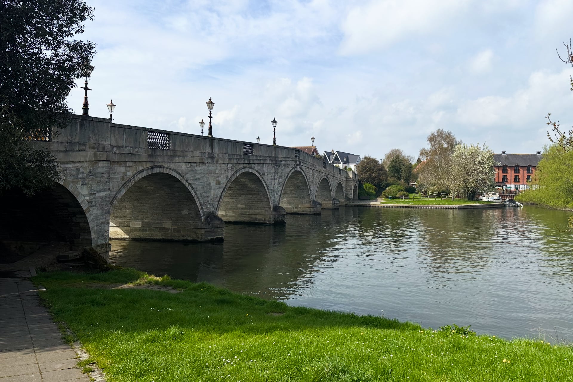
- [10/20] Teddington to Chertsey (24.2km): For all the remaining runs I ran west. At Weybridge I had to cross the river via a ferry. Although it felt delightfully old-fashioned to cross the river by ringing a bell to call the ferryman, it was still 2023 so he took Apple Pay.
- [11/20] Chertsey to Windsor (22.4km): Ran past Runnymede, shortly before Windsor Castle, which was the site of the signing of the Magna Carta in 1215. I had no expectation of seeing this so it was a nice surprise! Windsor was packed with tourists.
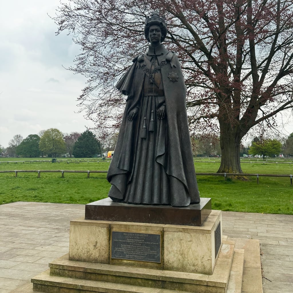
Statue of Queen Elizabeth II at Runnymede, even though I’m fairly confident she wasn’t around in 1215 to watch King John sign the Magna Carta.
- [12/20] Windsor to Bourne End (19.5km): Worth noting that around this section the Great Western Main Line and the Elizabeth line run close to the Thames, so there’s a lot of optionality for shorter/longer runs.
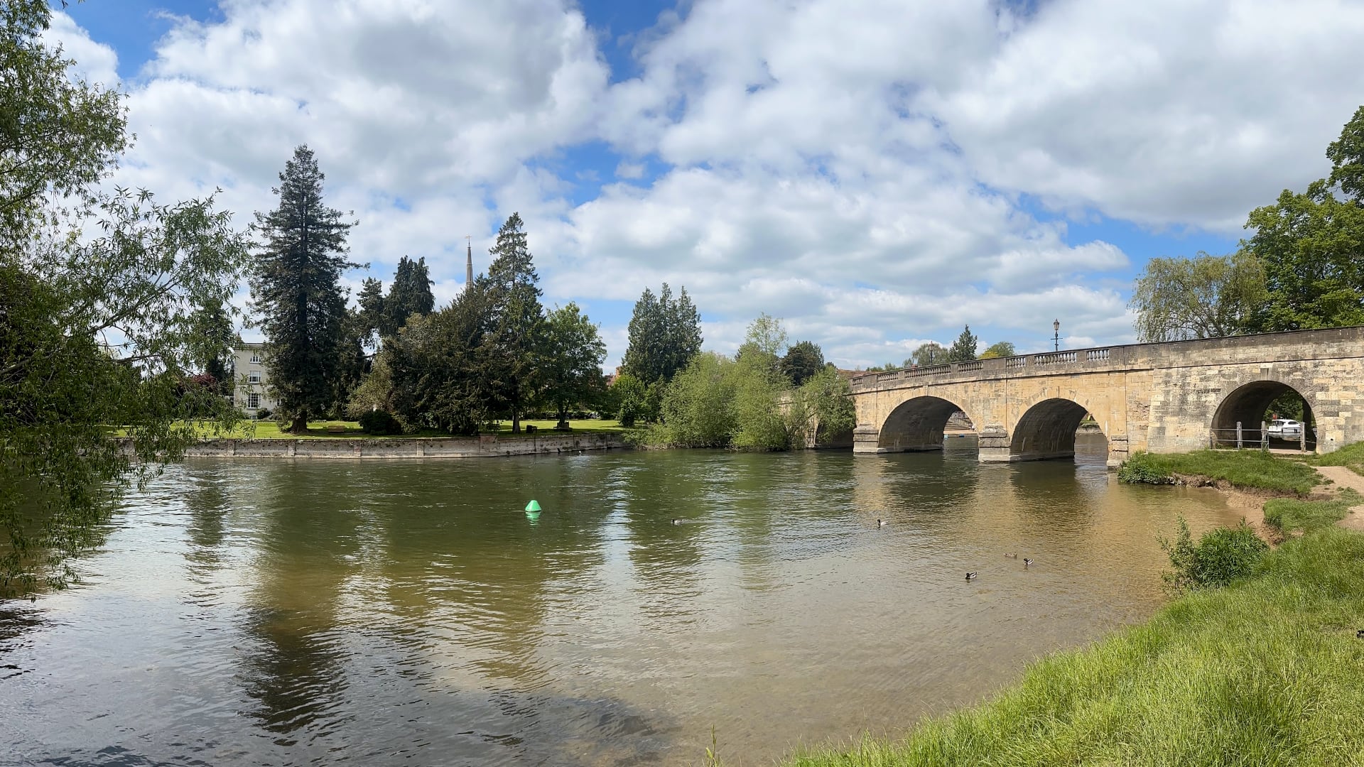
- [13/20] Bourne End to Henley-on-Thames (20.7km): Lots of pleasant countryside but the path I plotted often took me up over hills and away from the Thames. The river at Henley was the straightest part I think I came across.
Oxfordshire and Berkshire
For some of the Oxfordshire runs I took GWR trains directly from Paddington, whereas for others I stayed overnight in Oxford (which is also connected to London via slower Cross Country services from Marylebone).
- [14/20] Henley-on-Thames to Pangbourne (30.9km): Around this time I grew a bit more confident with distance but I had the option to cut the run short at Reading. The area around Reading was the last busy part of the Thames Path.
- [15/20] Pangbourne to Wallingford (25.1km): I ran a lot of this on The Ridgeway rather than the Thames Path. I originally plotted this route with a plan to take a train back from Wallingford Station … only to discover it was a heritage station with very infrequent services so afterwards I looped back and took a train back to London from nearby Chorley.
- [16/20] Wallingford to Radley (30.3km): I took a train to Didcot Parkway and a bus to Wallingford for the start of this one. The Thames Path crosses the river at Benson Lock but at the time the footbridge was closed; a ferry operated across the river instead. I suffered my worst hay fever reaction ever towards the end of this run so my pace dropped completely and I walked the last few kilometers back to Radley, where I then took a train to Oxford and another back to London.
- [17/20] Radley to Appleton (31.4km): This section loops through Oxford, so aside from colleges’ dreaming spires you also see Port Meadow, The Trout Inn (which features prominently in Philip Pullman’s The Book of Dust), and the ruins of Godstow Abbey (which features prominently in Mamma Mia: Here We Go Again). I’d argue these are the last tourist attractions on the run: the remainder is all through countryside and very small towns. I had virtually no service for the second half of the run which made navigating back to Oxford a bit of a challenge; I eventually walked to the A420 and got a local bus back.
- [18/20] Bablock Hythe to Lechlade (33.1km): The Thames Path switches to the opposite side of the river between Bablock Hythe and Appleton. I believe the pub at Bablock Hythe operates a ferry service, but at the time I was running it was closed. I therefore took a taxi from Oxford to start this run. St John’s Lock is the final (or first!) lock on the river, about a kilometer downstream from Lechlade. At Lechlade I took a local bus to Swindon and trains back from there.
Wiltshire and Gloucestershire
For all the Wiltshire and Gloucestershire runs I took trains to or via Swindon and then either local buses or taxis to reach towns or villages on the Thames.
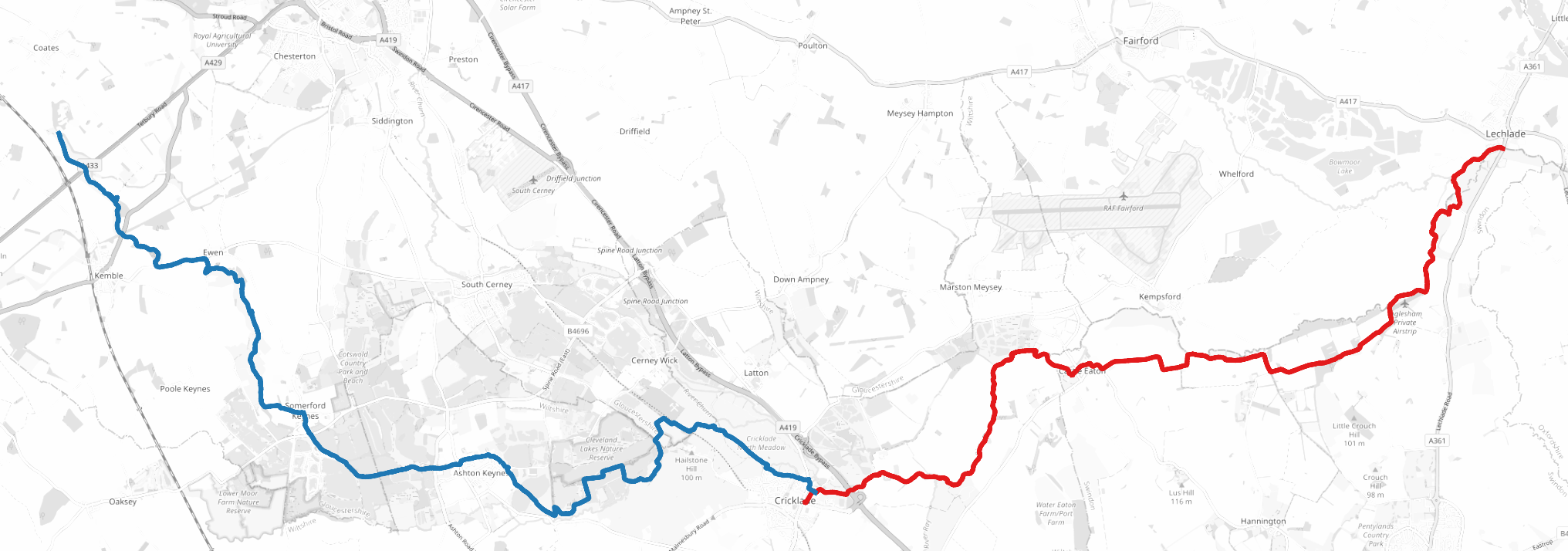
- [19/20] Lechlade to Cricklade (18.2km): Lechlade marks the end of the “navigable Thames” and aside from a few narrowboats anchored around Lechlade; I only saw one more rowing boat on the rest of the river. This was the quietest section: I only saw a handful of walkers and no other runners.
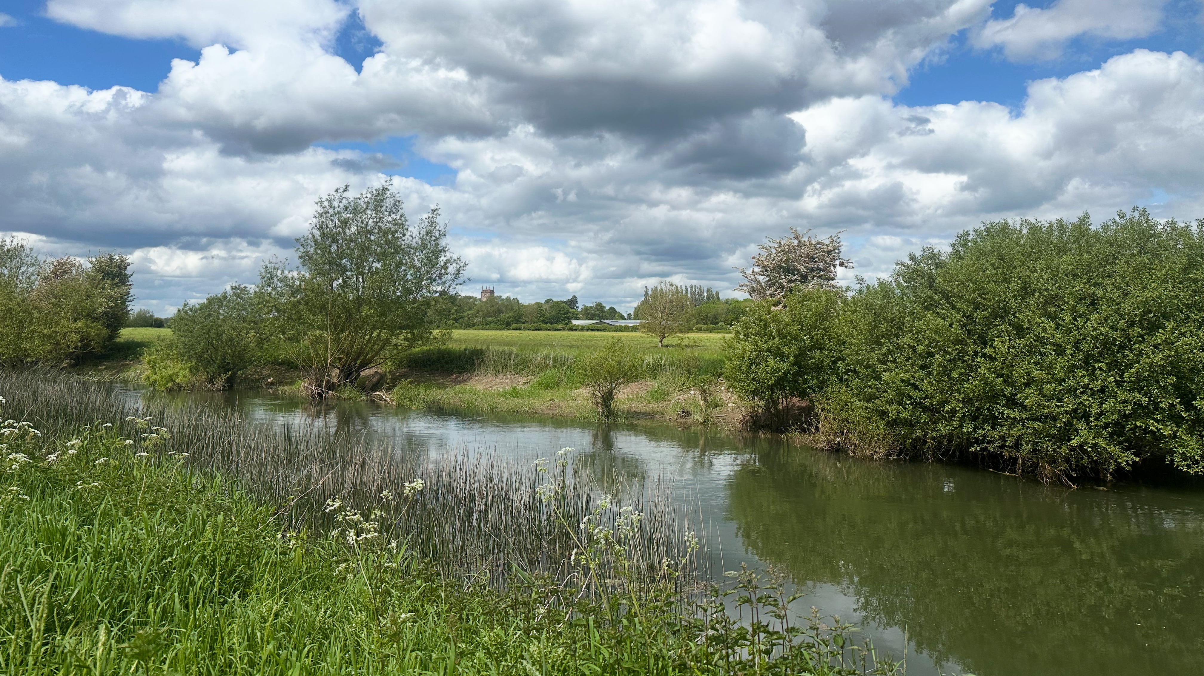
[20/20] Cricklade to Thames Head (22km): For the final leg through the Cotswolds I didn’t push the pace at all. The Thames Path hugged the river tightly but my route deviated slightly from it. The only challenge I had was when I encountered a herd of cows that took a little too much interest in me for my liking … the correct solution was not to climb through a barbed wire fence but instead to walk around them calmly, which I unfortunately learned the hard way.
By May the spring at Thames Head had dried up, but I instead found the spring that was the current source of the Thames tucked away in some woodland between the A433 and the A429. I wouldn’t recommend doing what I did, which was to wade through the Thames (it was only a few centimeters deep here!), cut myself on a whole bunch of brambles, and then get stung by a bunch of stinging nettles to find it. But on the other hand there was no chance I was going to run 400km and not find the start.
I continued on to Thames Head, the traditional start of the river and of the Thames Path. There I met a friendly group of walkers and runners, most of whom were about to set off down the path in the opposite direction. I considered getting a pint in at the Thames Head Inn nearby, but instead opted to avoid train delays and cancellations so I caught the train back to London from Kemble.
The final obvious question: “what’s next?” … A break?! The lesson from this project has been that I don’t mind travel for runs, just so long as the travel doesn’t take significantly more time than the run itself. That said, I’ve definitely got a couple more daft projects in the pipeline…